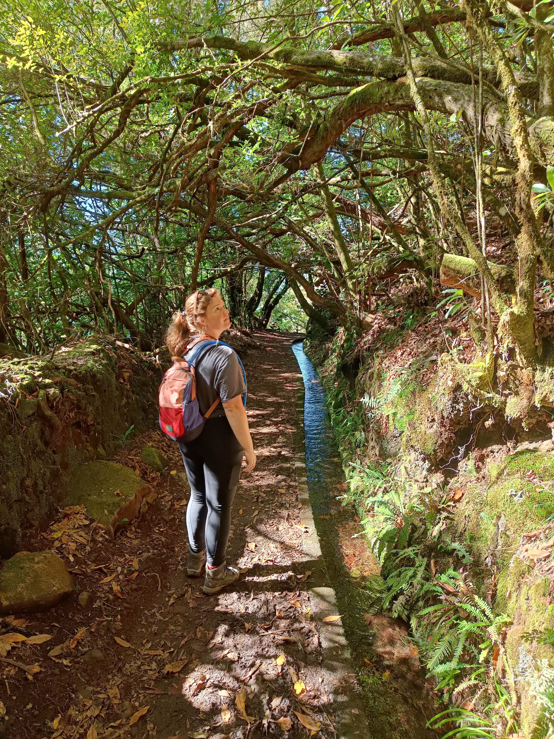
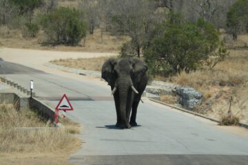
There are over 3000 km of trails on Madeira, and 30 official paths. I loved the diversity of hiking trails on the island, from an easy ‘walk in the park’ to an intense hike up the mountain. They all show different sides of Madeiran nature, such as the lush tropical forests or the mysterious laurel forest, or the strangely desert-like peninsula! All have amazing viewpoints along the way, either of a waterfall, valley, ocean or even abyss.
Looking for a great itinerary for your next trip to Madeira? Check out my 14-day Madeira itinerary here.
Here I share my top 5 hikes on Madeira, and how you can do them too!
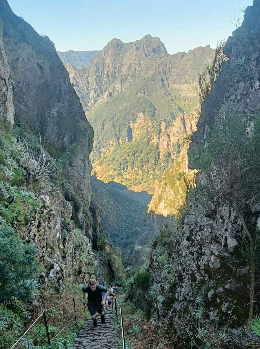
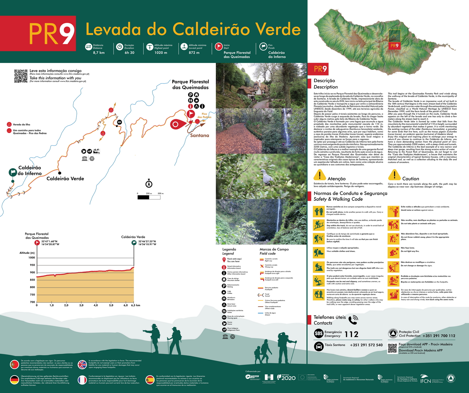
PR 9 - Levada do Caldeirão Verde
- Length
- Type
- Elevation
- Difficulty
- Starting point
- Route
13 km (round trip)
Out-and-back hike
Overall flat and well-maintained. Some narrow parts with steep cliffs, but doable despite fear of heights
Easy
Queimadas forest park
Find a map here. Or on the official website.
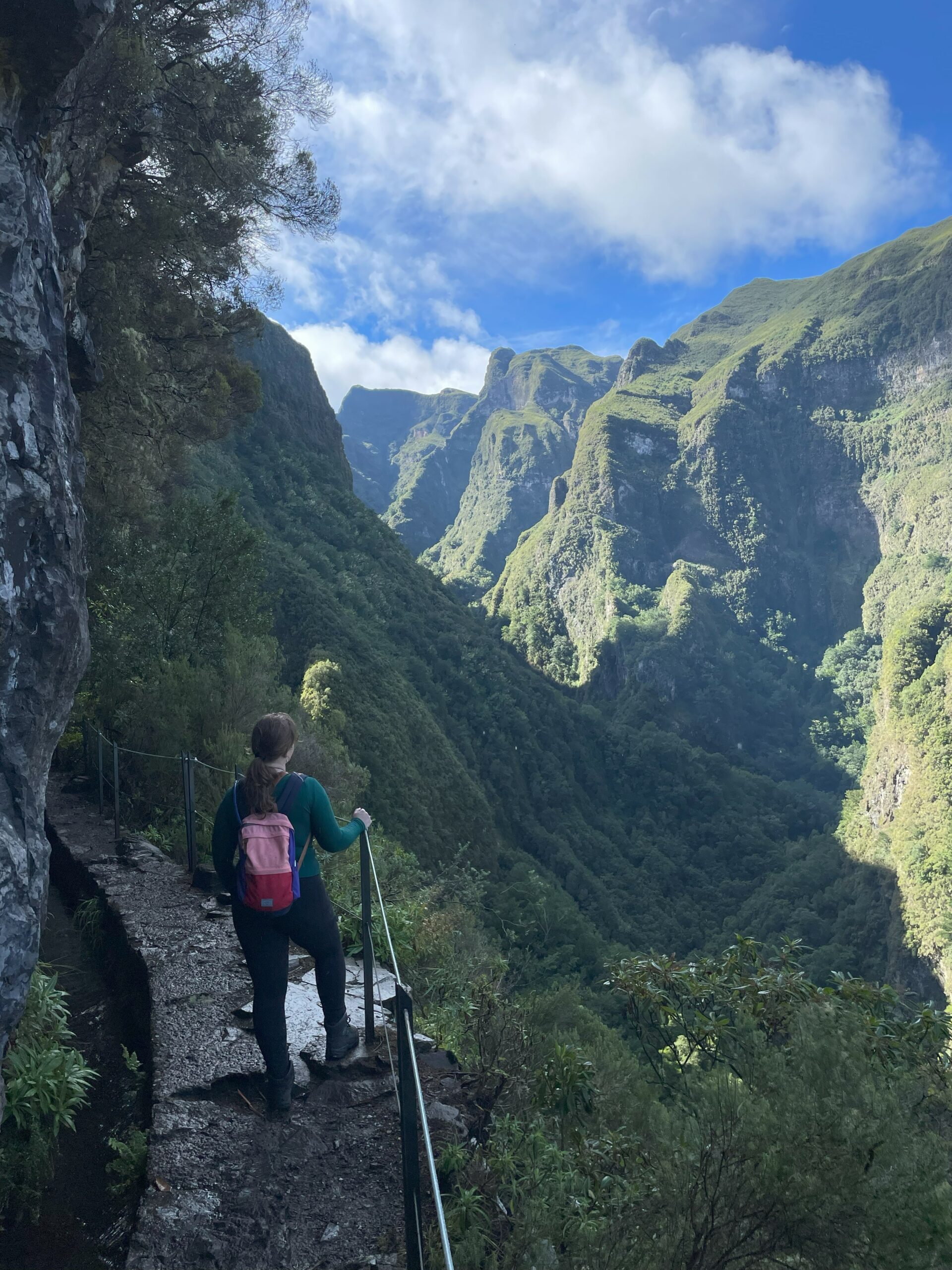
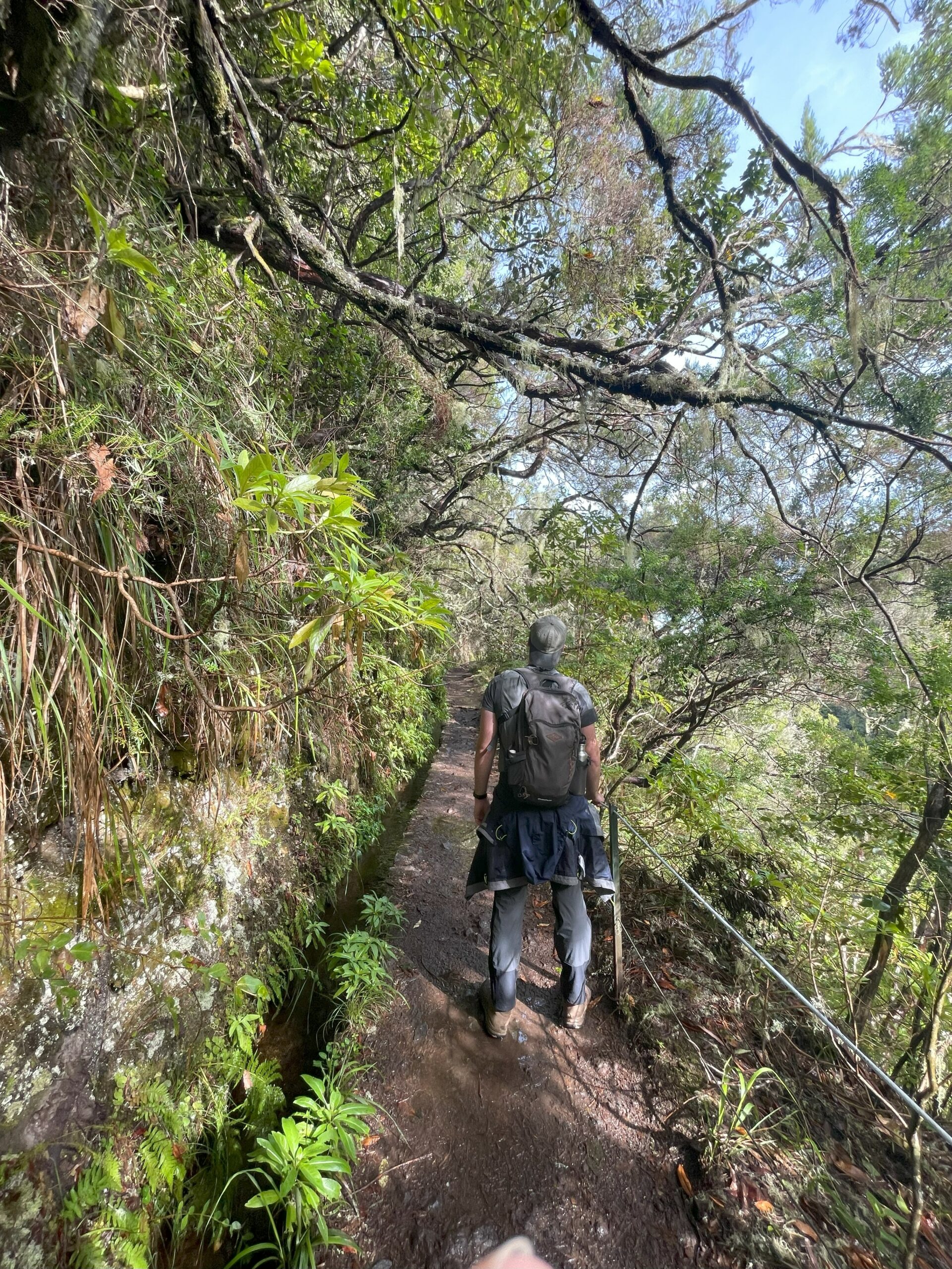
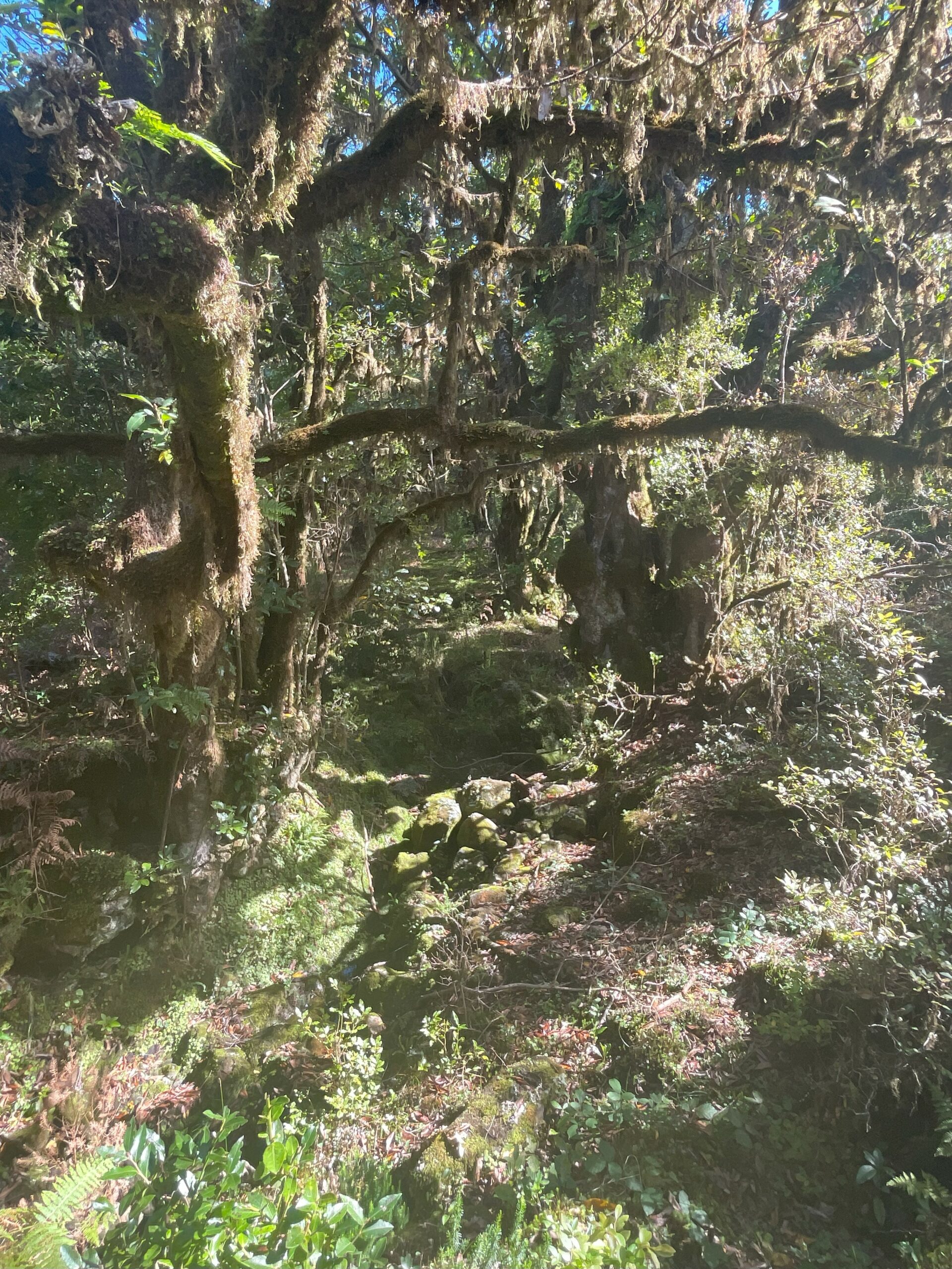
The ‘green cauldron’ hike. A magical and often misty hike that takes you along the side of a mountain, following a levada all the way to a glorious waterfall, the Caldeirão Verde. You are immersed in a lush forest with many weirdly-shaped ancient trees. Even though you will walk the same way back, it’s still enjoyable as it will all look a bit different.
You can make this hike longer (and a bit more challenging) by adding the Levada Caldeirão do Inferno to it. This requires a bit of a climb and as it’s not part of the official trail, it is not well maintained so it can be a bit more dangerous. This is an extension, so you keep going after you reach the Caldeirão Verde waterfall. The final length will then be 17,4km (return).
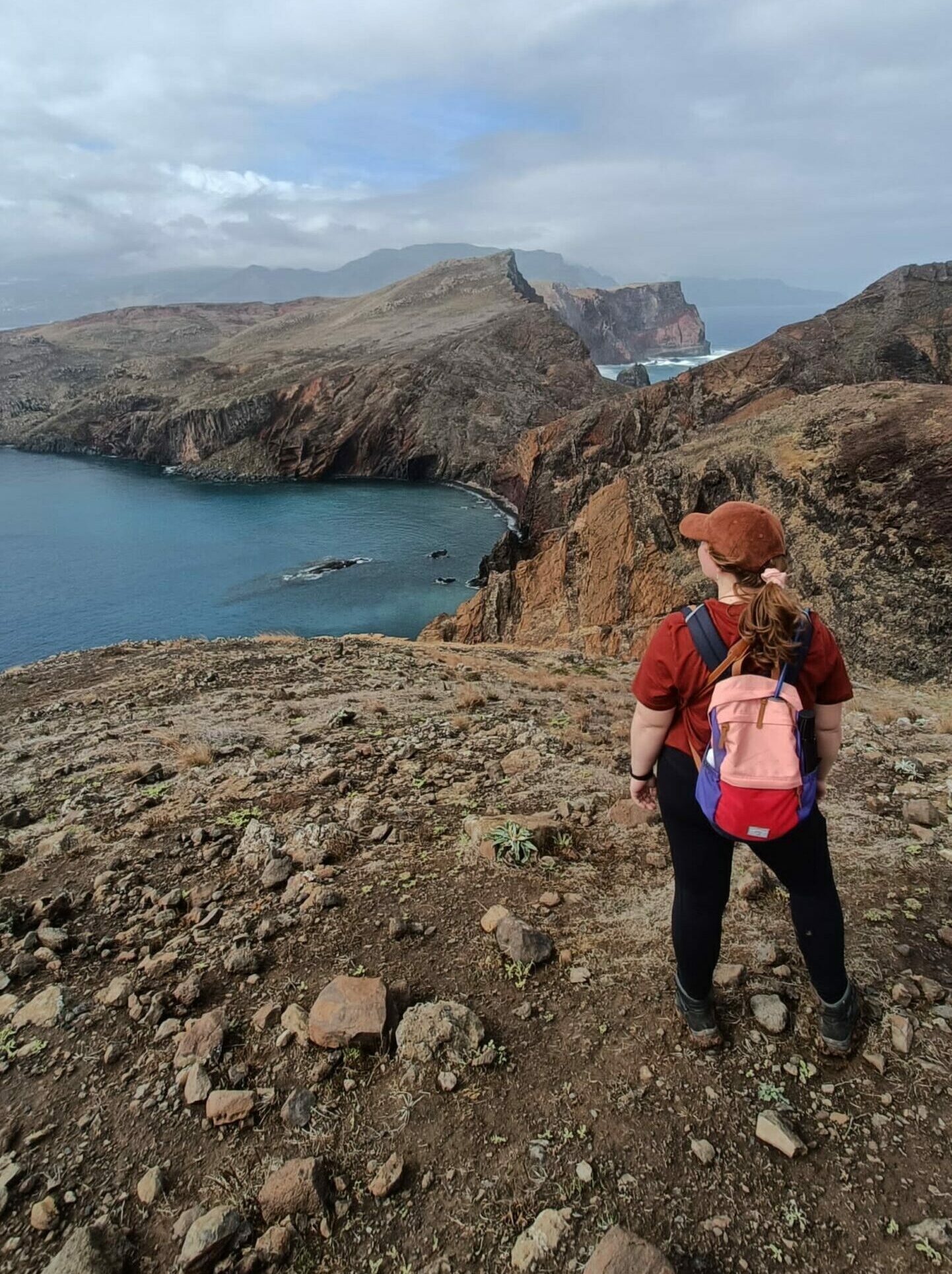
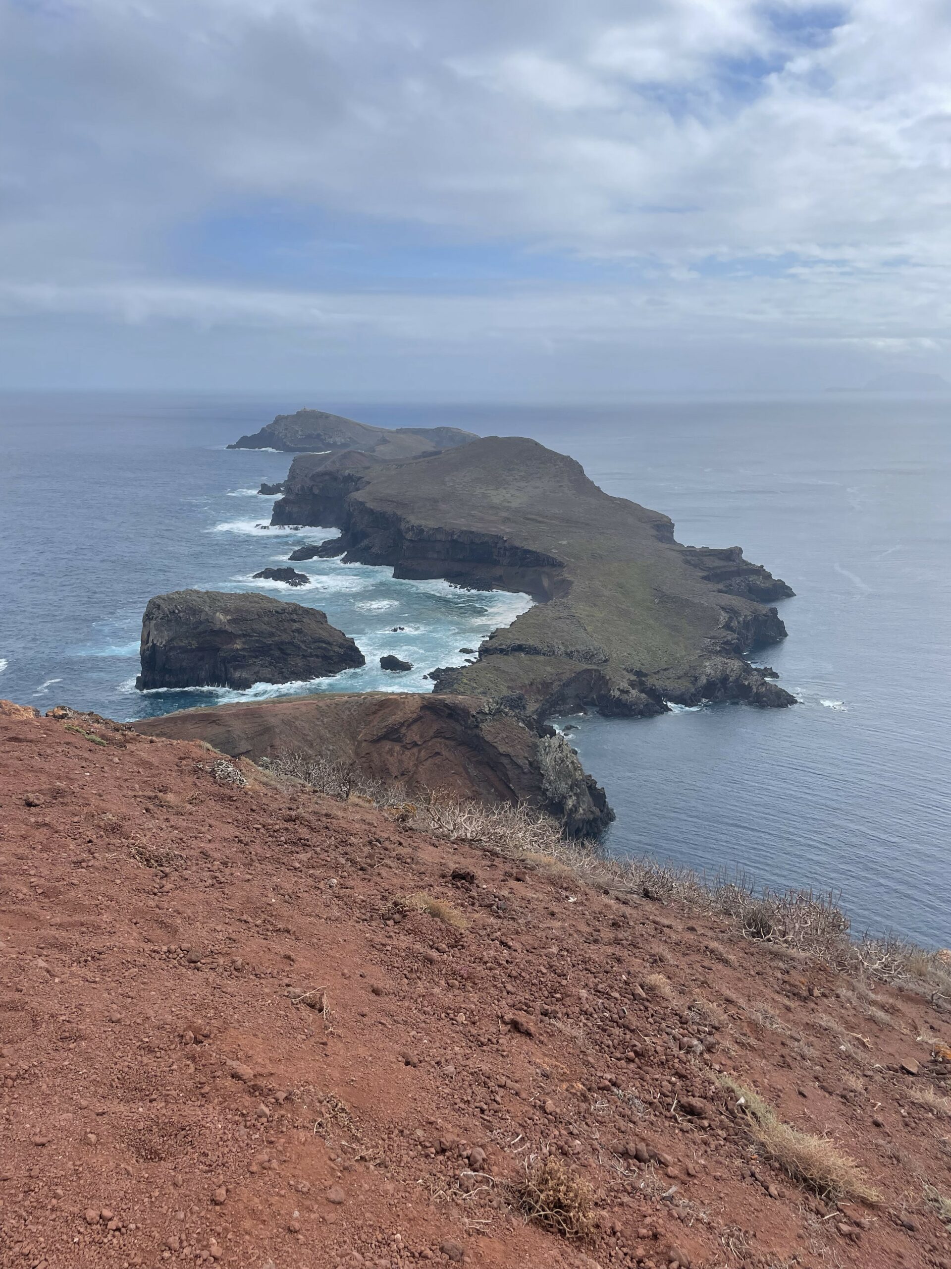
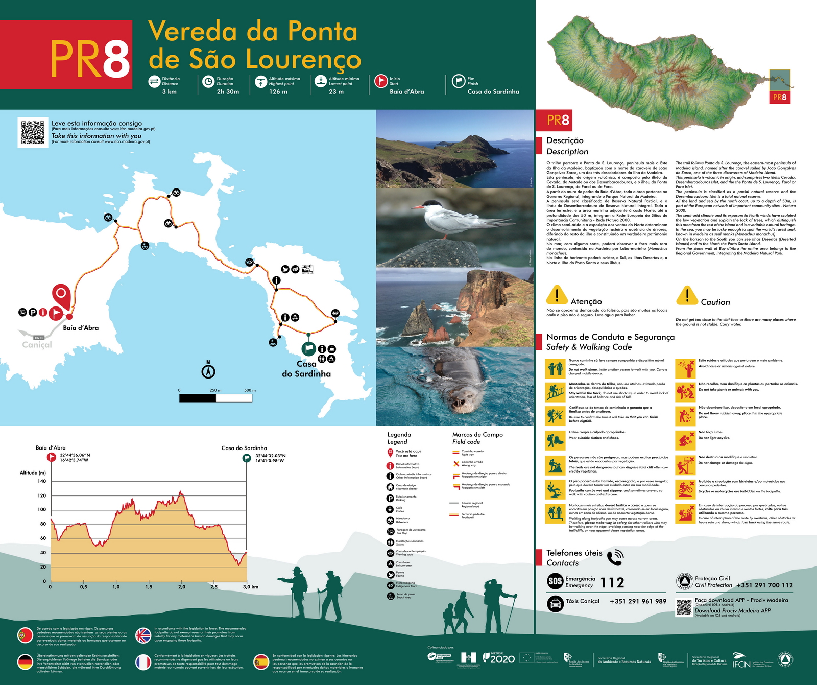
PR 8 - Vereda da Ponta de São Lourenço
- Length
- Type
- Elevation
- Difficulty
- Starting point
- Route
7 km (round trip, including the viewpoint)
Out-and-back hike
Goes up and down quite a bit, well maintained. About 600 m including the final viewpoint
Moderate
Ponta de São Lourenço car park
Find a map here. Or on the official website. It mentions an entry fee, but that isn’t enforced
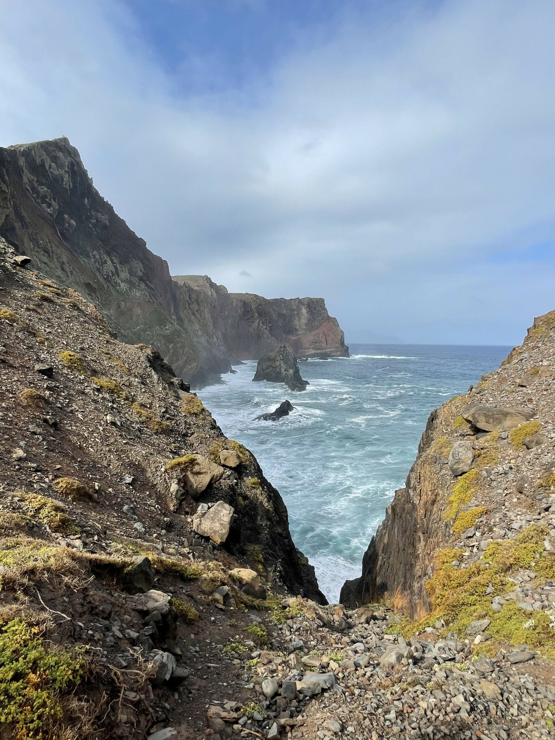
Ponta da São Lourenço is the volcanic peninsula on the northeastern tip of Madeira. It has a noticeable different landscape, without any trees and looking very arid most of the year. It is beautiful nonetheless and the trail takes you all the way to the end, providing a gorgeous view of Madeira, the peninsula and the other islets. On clear days you can also see the Desertas islands and even Porto Santo. There are oddly-shaped volcanic rocks sticking out from the shore, and the ocean has these incredible blue colours.
The official trail goes upto the little cafe (6km return), but you can extend the route a bit by hiking all the way up to the last view point ‘Miradouro Ponta do Furado’. These final 500 meters are a grueling climb, but definitely worth it when you see the view at the end. The official trail is well-maintained throughout, but can be very muddy if it’s raining or has rained that night or morning. The last part to the viewpoint isn’t maintained and can require some support with your hands for uneven steps.
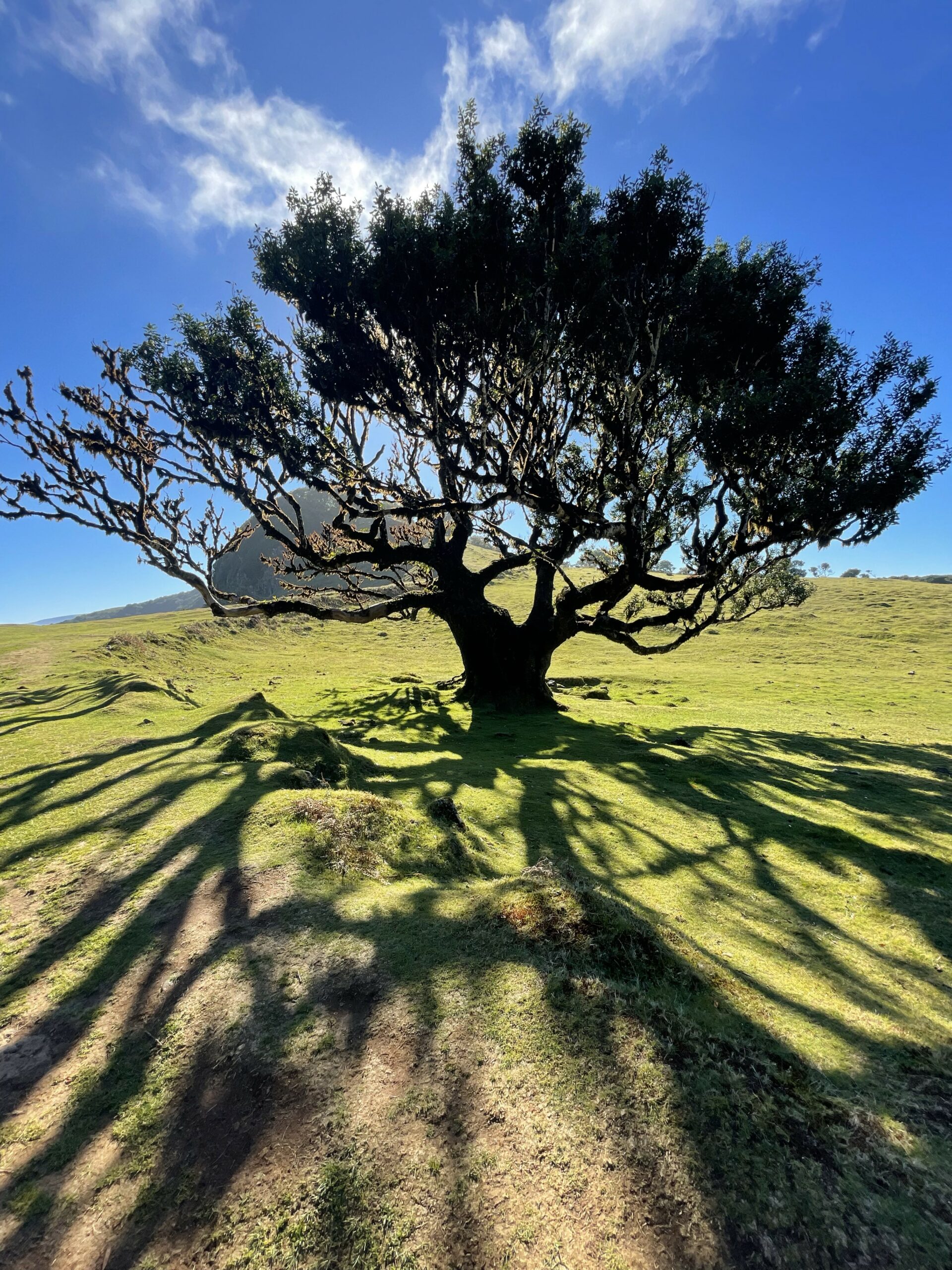
PR 14 - Levada dos Cedros and Fanal forest
- Length
- Type
- Elevation
- Difficulty
- Starting point
- Route
12 km (round trip)
Officially point-to-point, but we found a circular route
Mostly well-maintained, including some stairs. Total elevation of about 300m
Moderate
Lagoa do Fanal car park
We took this circular route and visited Fanal forest first. The official website. The final part follows a mountain bike trail, which is a bit more uneven.
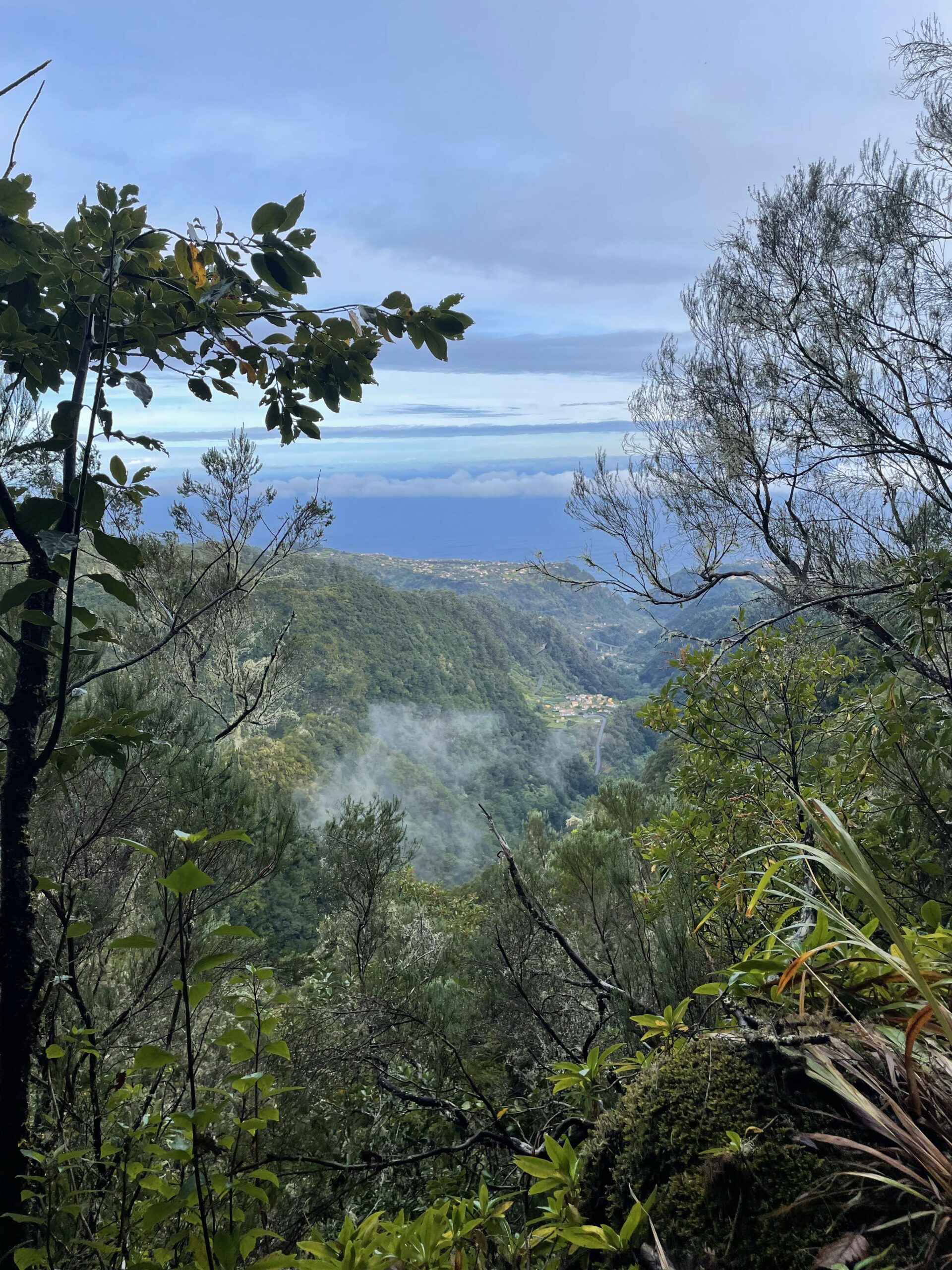
There are several ways to experience the beautiful Fanal Forest. Like many hiking routes on Madeira, most are point-to-point or out-and-back hikes. The official Fanal hike “PR 13 Vereda do Fanal” is a long one-way hike, which we only could’ve done with a tour or by going the same way back. This would have made it over 20km.
This circular route combining Levada dos Cedros with a visit to Fanal forest was great alternative. You’ll be able to explore the mysterious laurissilva landscape early on (hopefully without crowds), with its ancient laurel trees that cover an otherwise empty grassland. After that the route takes you down to a levada that follows the ridge of the mountain. Most of the hike is in the shade, with the occasional opening showing beautiful views of the mountain. Perfect hike for those looking to get out of the sun.
Curral das Freiras and Eira do Serrado
- Length
- Type
- Elevation
- Difficulty
- Starting point
- Route
9 km (round trip)
Officially point-to-point, but we took a circular route.
Total gain of about 400m. It goes up gradually, but the way down is quite steep.
Easy (if you take Eiro do Serrado down
Capela São Rafael
This hike is not maintained by the Madeiran Government. We took this route. The Eiro do Serrado is well traversed.
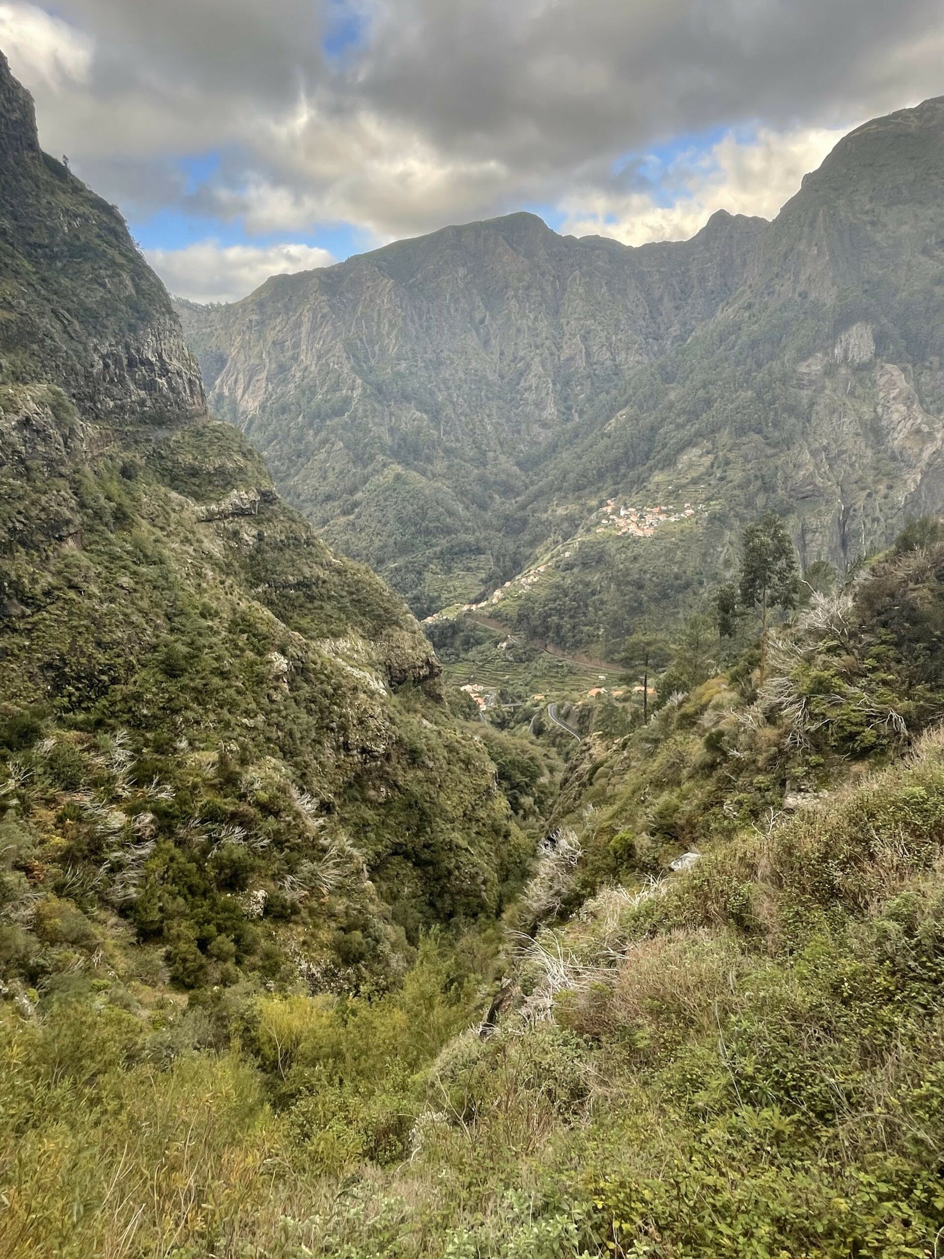
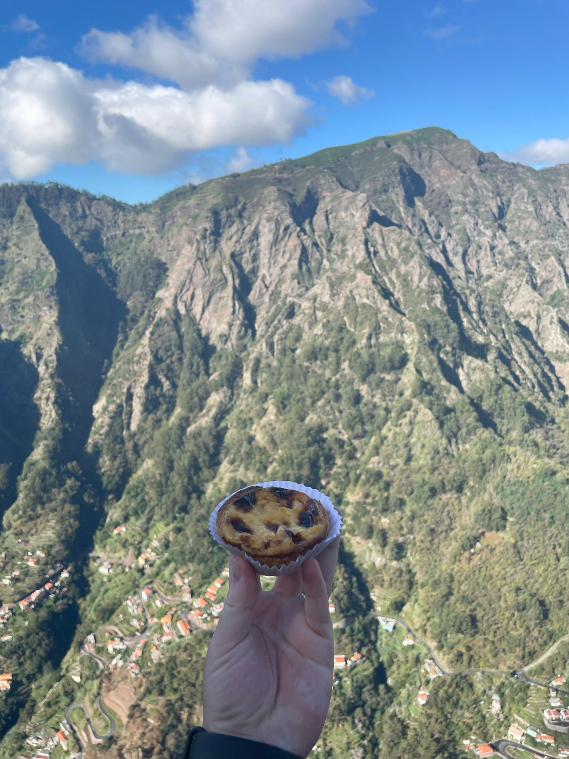
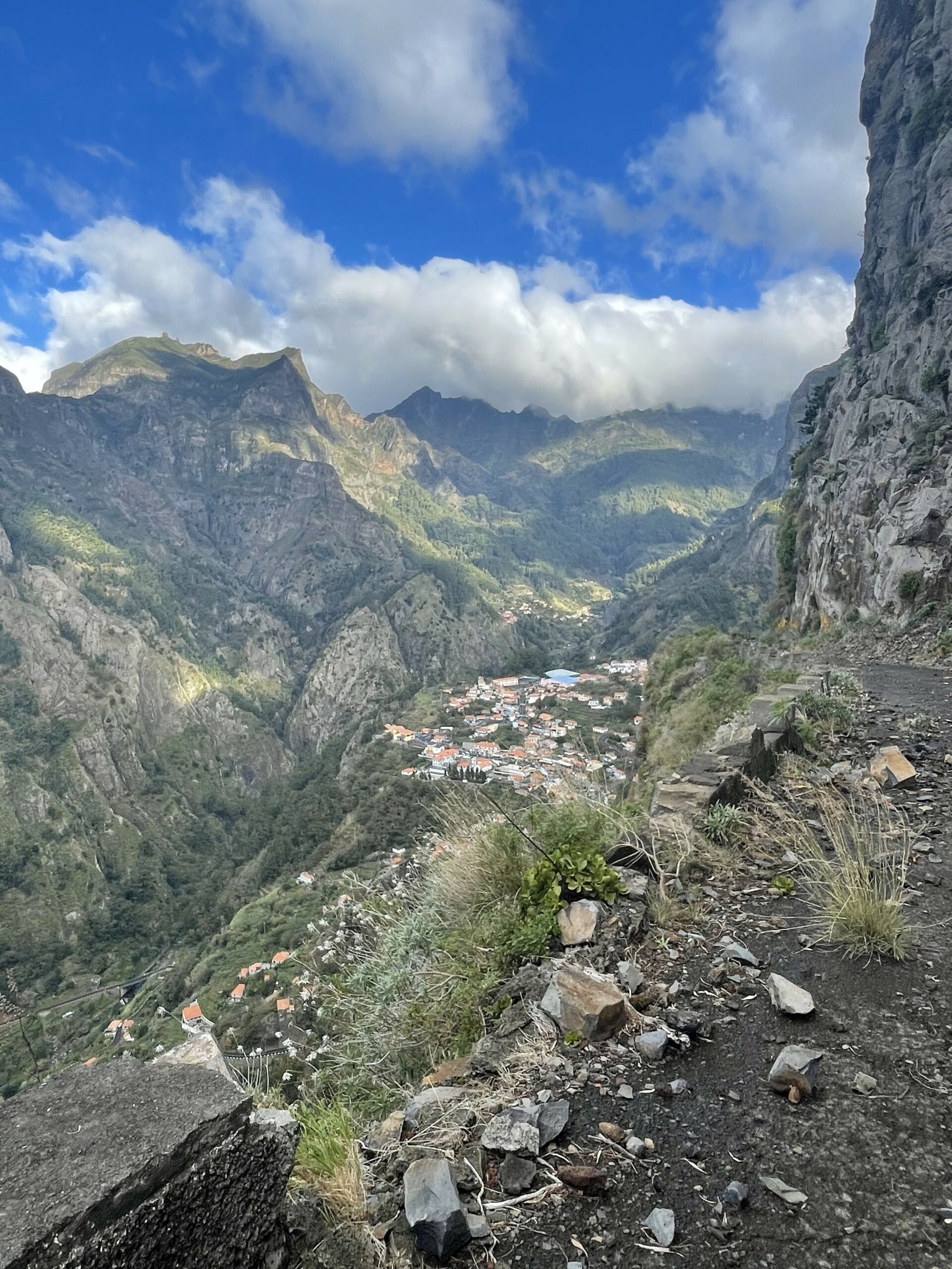
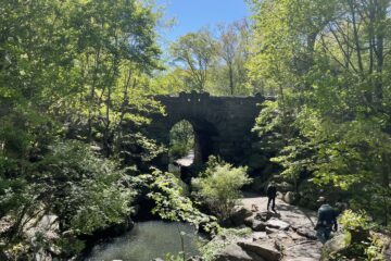
Curral das Freiras, or Nun’s valley, is another beautiful part of Madeira. A tiny village is surrounded by high mountains. This circular hike shows you the most beautiful views of the valley and gives you a little adventure on the abandoned road with tunnels. On the top you will find a hotel and a popular viewpoint, called Miradouro Eira do Serrado. On the way down you follow the Nun’s path, which is steep but manageable. You can distract yourself with some more stunning sights of the mountain. Once you’re down below you can hike to the starting point through the town (and stop by the lovely cafe “Naibers”), or take the bus at one of the stops along the way.
This hike and the Miradouro Eiro do Serrado can easily be reached by public transport. Bus 81 will take you from Funchal to several points within Curral das Freiras. The first part follows an abandoned road and is to be done with caution, as rocks may fall down and the road can be unsteady at some points. The ‘official’ Eiro do Serrado path can be uneven as some of the steps have broken down, but is a wide path with fencing at the more exposed parts.
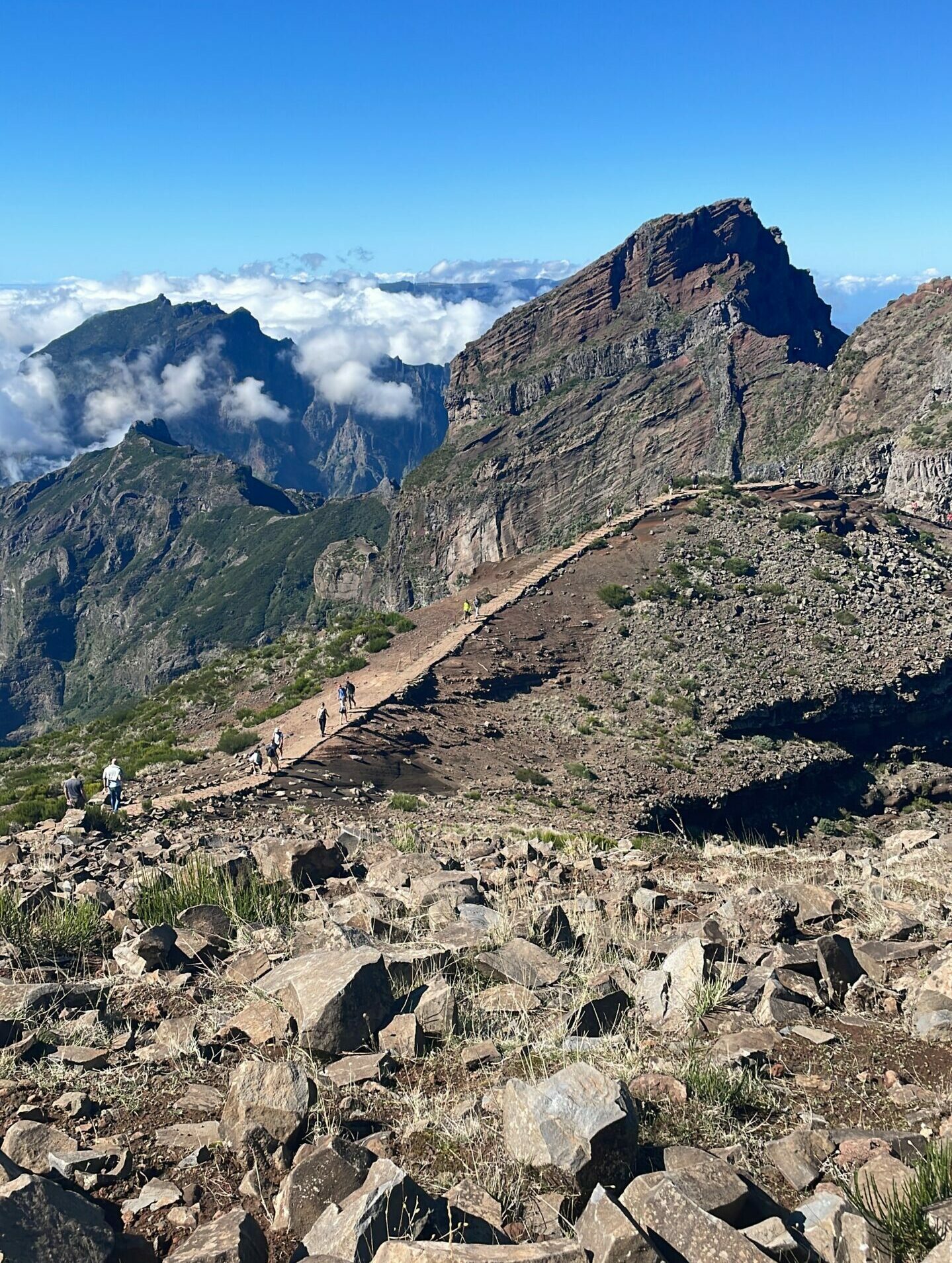
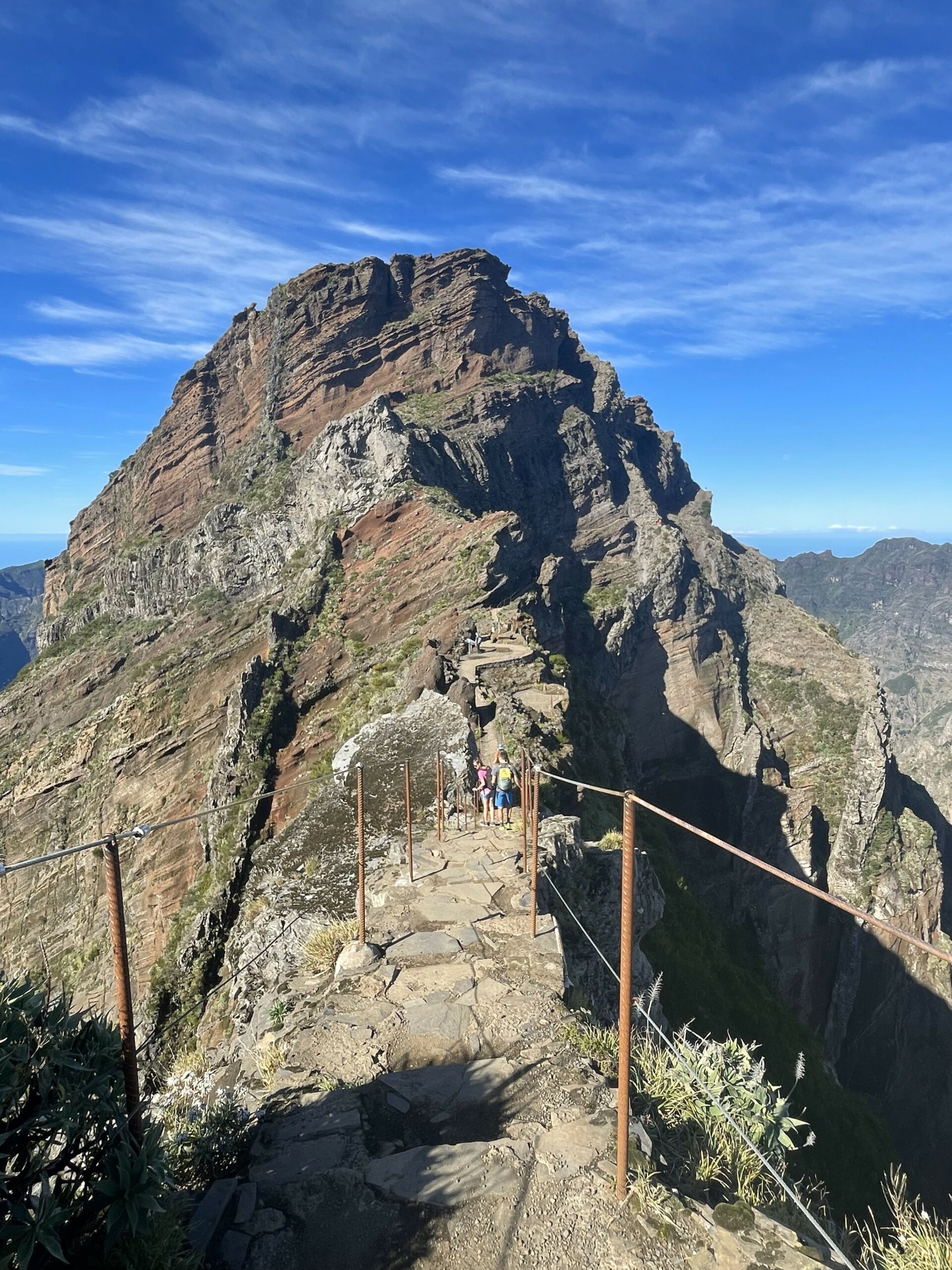
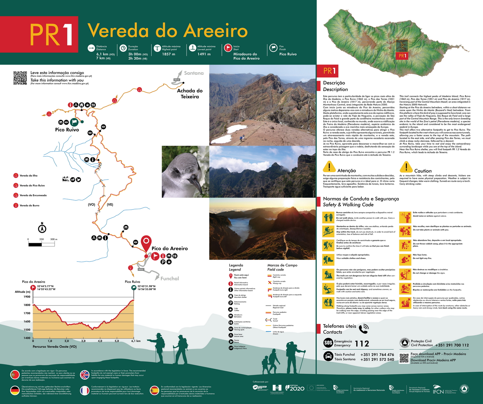
PR 1 - Vereda do Arieiro
- Length
- Type
- Elevation
- Difficulty
- Starting point
- Route
4 or 12 km (round trip)
Out-and-back hike
If you go all the way to Pico Ruivo and back, the total elevation gain is about 800m.
Moderate to hard
Pico Arieiro parking
Find a map here. Or on the official website.
This challenging hike goes from peak to peak and follows the ridge of the mountain. The full route brings you to the highest peak of Madeira, the Pico Ruivo. It goes up and down steep steps, and even through tunnels. All the way it provides stunning views of the central mountain massif and shows you unique volcanic rock formations.
Even if you don’t like hiking, Pico do Arieiro (Areeiro in Portuguese) is a must-see when you visit Madeira. Because of my crippling fear of heights I wasn’t able to do the full Vereda do Areeiro. I made it to Miradouro do Ninho da Manta and a bit further, but I turned around where a short part of the path had both sides exposed to the abyss. I only did about 4km (return) total, but it gave me views for days. Around the starting point there are also many beautiful viewpoints, such as Miradouro do Juncal, which shows you beautiful views of the ocean and is popular for sunrise visits.
What didn’t make the list
Another popular area for hiking is Rabaçal, south of Fanal forest. The well-known PR 6 Levada das 25 fontes can be found there. This trail can get very crowded, so we visited PR 6.2 Levada do Alecrim and a bit of PR 6.3 Vereda da Lagoa do Vento. These routes are parallel to PR 6 and give you the same vibe, but without lots of people. We liked this area, but it didn’t make the list. It felt similar to Levada dos Cedros we did the day before.
Other popular hikes are PR 22 Vereda do Chão dos Louros and PR 11 Vereda dos Balcões, but we unfortunately didn’t have time for these. These are both short but provide great views and a good essence of hiking on Madeira, so could be good options if you are not into hiking but want to experience Madeiran nature.
1 Comment
14-day itinerary for an adventure on Madeira - Loose Travels · April 1, 2024 at 10:58 am
[…] viewpoints and show you the amazing natural diversity of the island. Read my post about our favourite hikes on Madeira […]